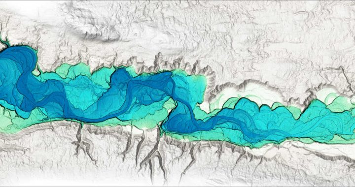
In this article, we explore how Relative Earth Models (REMs) can be used to visualize floodplains. Fluvial environments have significant natural and anthropogenic roles. Rivers are key features that shape our natural environment and create important ecological habitats. Additionally, they have numerous uses, including those relating to transportation, hydroelectricity, and recreational activities. While many reasons may attract us to them, these dynamic environments can also repel us with flood events and the dramatic hydrodynamic forces that shape rivers – the recent landslide event in the Chilcotin River (located in the Cariboo Regional District, British Columbia) being an example of such forces at play. This duality makes fluvial environments an important subject of study. The Role of Topography in River Systems Topographic data is often represented by a Digital Elevation Model (DEM), where an elevation value is assigned to each pixel in an image. These values can represent the ground or bare earth as in the case of a Digital Terrain Model (DTM). Due to river systems flowing downhill, a decreasing trend will be present in the elevation values of the DTM. Within these trending elevation values, there are smaller topographic features that make up the river corridor. These features play a significant role in the river’s hydraulics and will influence the way in which sediment is eroded or deposited. Floodplain Visualization with Relative Earth Models A technique used to better understand these topographic variations is a Relative Earth Model (REM) or Height Above River (HAR) raster. An REM is created by removing the downward slope of the river, and leaving only the local topographic features so that the resulting elevation values are relative to the height of the river. REMs are primarily used as a tool to visualize river corridors, and can be used to identify historic river features as […]
Continue reading